Engineering Geology & Remote Sensing Lab
Engineering Geology & Remote Sensing Lab
Faculty Lab In charge: Lokesh Choudhary
About the lab:
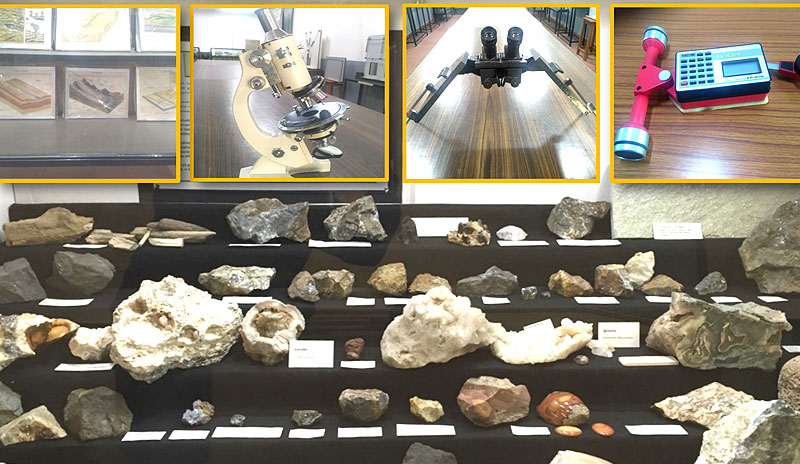
Remote Sensing lab is equipped with the facilities of visual Image interpretation, stereoscopic projections and all type of photogrammetric and geo-referencing studies. Research work related with watershed planning and development and satellite image interpretation are performed in the lab. Studies related with different rock and mineral identification, making tunnel cross sections, dip and strike measurement of rock formations and study of various thematic maps is carried out.
Equipment:
- Compass Brunton, Compass Clinometer, Geological Model India, Geological Map of India, Tectonic Map of India, Geological Hammer, Mineral Samples, Rock Samples, GPS Garmin ETREX., Polarizing (petrological) Microscope
- Compensator, Igneous Rock then Section Slide, Sedimentary Rock Slide, Metamorphic Rock Slide, Mineral Slides
- Black Surface Outline Globe (GL0028), Wooden Block Model showing fold, fault, unconformity – set of 25nos.
- 3D Geomorphological model – set of 16nos. in aluminium frame
- Hardness Scale Box, Hardness Kit Box
- Pocket Magnet, Horseshoe type, Rocks Hand Specimens, Mineral Hand Specimens
- Pocket Stereoscope, Book Aerial Stereo Photo (HB001), Aerial Stereo Studies (HB002)
- Stereogram Book of Contour (HB004), Stereo Atlas (HB003)
- Mirror Stereoscope, Parallex Bar, Planimeter Digital
- Planimeter Mechanical